Overview
Key Features
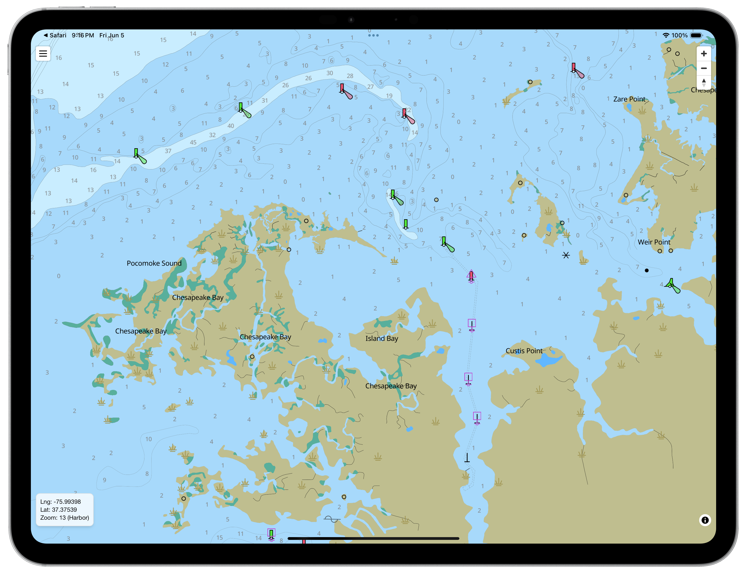
Luna Marine Charts is a fast, modern marine navigation application built for sailors, cruisers, and recreational boaters.
Plan routes in minutes, explore NOAA and USACE nautical charts with smooth zooming and panning, and access chart data, tides, and currents even when you're offline. Whether you're preparing at home, planning a coastal passage, or navigating on the water, Luna helps you stay informed and focused.
Charts & Offline Access
- Download NOAA coastal charts and USACE Inland River charts for offline use
- Access charts, tides, and currents without an internet connection
- Integrated tide and current stations with charts and tables
- Smooth, clear chart display at every zoom level
- Full coverage of U.S. coastal waters using official NOAA data
Route Planning
- Create routes quickly with simple waypoint placement
- Automatically calculate distance and bearing between waypoints
- Drag waypoints to adjust routes instantly
- Insert new waypoints anywhere along an existing route
- Export routes as GPX files for use with other navigation tools
Auto Route Options
- Path Finder: Calculates practical routes around land and navigation obstacles. Considers water depth and chart data when available
- Great Circle: Calculates the shortest path between two locations on Earth. Ideal for longer offshore passages
Clear, Customizable Display
- Day, dusk, and night display modes
- Show or hide chart layers including buoys, lights, and landmarks
- Reduce chart clutter and focus on relevant information
- Choose preferred units for depth, distance, and speed
Tides & Currents
- Tide & Current Support: NOAA Tide and Current station data are now integrated into the map.
- Instant Access: Tap a Tide station icon for water level predictions, or a Current icon for flow speed and direction.
- Prediction Graphs: Data is presented in both a graph and table along with relevant metadata.
Designed For Boaters
- Whether you're planning a day sail, cruising the coast, or preparing for a longer voyage, Luna Marine Charts provides fast route planning, offline NOAA and USACE charts, and essential navigation information in a clean, easy-to-use interface.
Download & Installation
Mac OS / Phone / iPad
Android
Mac OS (DMG download)
DMG (Apple Silicon): Download now
Windows
Windows Installer (Intel x64): Download Now
Note: The Windows build is not currently code signed and will display SmartScreen warnings.